Live
- DEO suspends teacher accused of sexual assault
- PM ‘cursing’ Congress out of despair: Maharashtra Cong Chief
- Applications are invited for Junior Colleges Scheme District Scheduled Castes Development Officer Ramlal
- A nomination was filed on the second day for the Nagar Kurnool parliamentary seat
- SP Gaikwad inspected the Telangana Amarnath Saleswaram Jatara yatra arrangements
- Rahul Gandhi's decision to contest from Wayanad shows 'lack of confidence': BJP President Nadda
- IPL 2024: Delhi bowlers will go after all of SRH’s top-order batters, says head coach Ricky Ponting
- At Amroha rally, PM Modi sends out ‘meaningful’ message for Muslims and Hindus
- Tripura records highest 79.83 pc voter turnout in Northeast
- The government has to clear the confusion
Hyd gallery to be in National Museum map show


Hyd gallery to be in National Museum map show. The event, slated to end on October 11, will simultaneously unveil competing global interests and influences—religious, economic and political—that have contributed to the perception of ‘India’ as we understand it in the present times, according to the organisers.
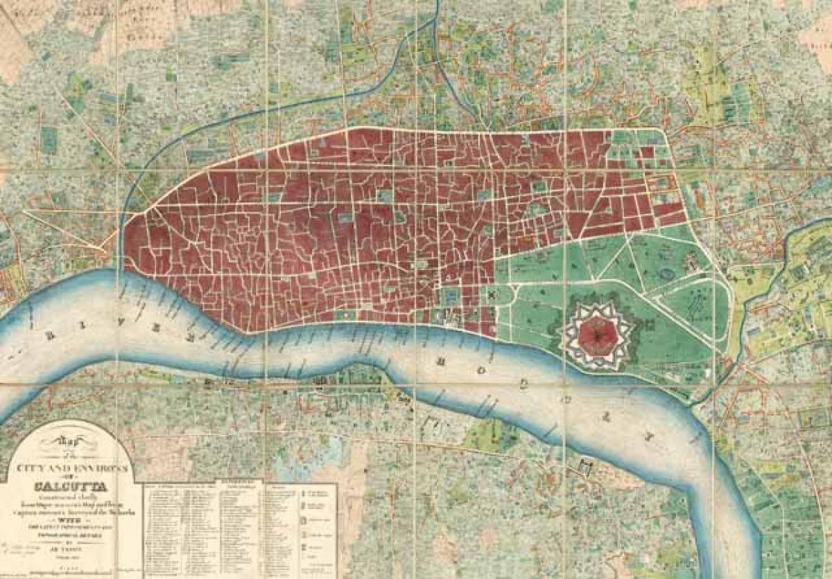
Hyderabad : A unique exhibition of a wide range of maps on the Indian sub-continent ever since the evolution of its more accurate techniques from the 15th century will be on display in the capital from next week when National Museum (NM) will begin the two-month show, courtesy the country’s most comprehensive private collection of historic maps.
- Kalakriti Archive lends majorly to 72-map ‘Cosmology to Cartography’ event
- Extraordinary variety of painted and printed Indian maps to be showcased at the exhibition
Hyderabad-based Kalakriti Archive, which is bringing in all but two of the 72 maps in the exhibition titled ‘Cosmology to Cartography’ beginning August 11, will thus facilitate a virtual travel back in time to the genesis of early cosmological representations of the ‘World of Mortals’ to the growth of modern map-drawing.
The event, slated to end on October 11, will simultaneously unveil competing global interests and influences—religious, economic and political—that have contributed to the perception of ‘India’ as we understand it in the present times, according to the organisers.
National Museum Director-General Sanjiv Mittal noted that the upcoming exhibition would feature an extraordinary variety of painted and printed Indian maps produced in the subcontinent and internationally, including original manuscript representations.
Prashant Lahoti, who heads the Kalakriti Archive, said the show would also capture the development of the Indian printing industry, which although established by Europeans, came to be heavily influenced by Indian artistic styles and technology.
“Monumental original paintings of profound religious symbolism from the 15th to 19th Centuries will be juxtaposed with ground-breaking historical maps of India, many of which are unique and have never before been placed on public view,” he pointed out.
Covering themes from pilgrimage to clashing empires, the exhibition begins with Jain and Hindu cosmological representations. These progress to magnificent painted hangings on a monumental scale depicting sacred rivers and pilgrimage sites, besides representations of the pilgrim’s temple.
The exhibition also features cartographic depictions of the ancient European conception of the subcontinent, and the first vaguely accurate maps of India made in the wake of Vasco Da Gama’s arrival in 1498.
Towards the more recent times are maps of medieval Hyderabad and Bangalore, and the Enlightenment model of French Pondicherry. Visitors will also discover extraordinary plans of future metropolises such as Mumbai, Kolkata and Delhi.
Of the two maps from the NM reserve, one is an 18th-century Rajasthani image of Lord Krishna showing his cosmic Vishwaroopa form, while the other is a five-century-old water colour work showing Hyderabad’s Nizam Ali Khan giving audience to French envoy M Bussy with the Walled City as a sprawling backdrop.


