Live
- A Guide to Temperature and Humidity Standards in Data Center Server Rooms
- Gadwal collector briefs on details of voters
- Jupally Krishna Rao takes part in Alampur rallu
- Bharath Prasad files 3rd Nomination
- Baisakh Month: A Time of Auspicious Beginnings and Sacred Festivals
- Oust BJD govt for overall development, says Shah
- Unveiling the Hidden Gems: Surprising Health Benefits of Garlic Peels
- Overcoming Sleep Struggles: A Comprehensive Guide to a Restful Night
- RTC bus hit the auto
- MLA Kuchukula Rajesh Reddy participated in the Birappa festival
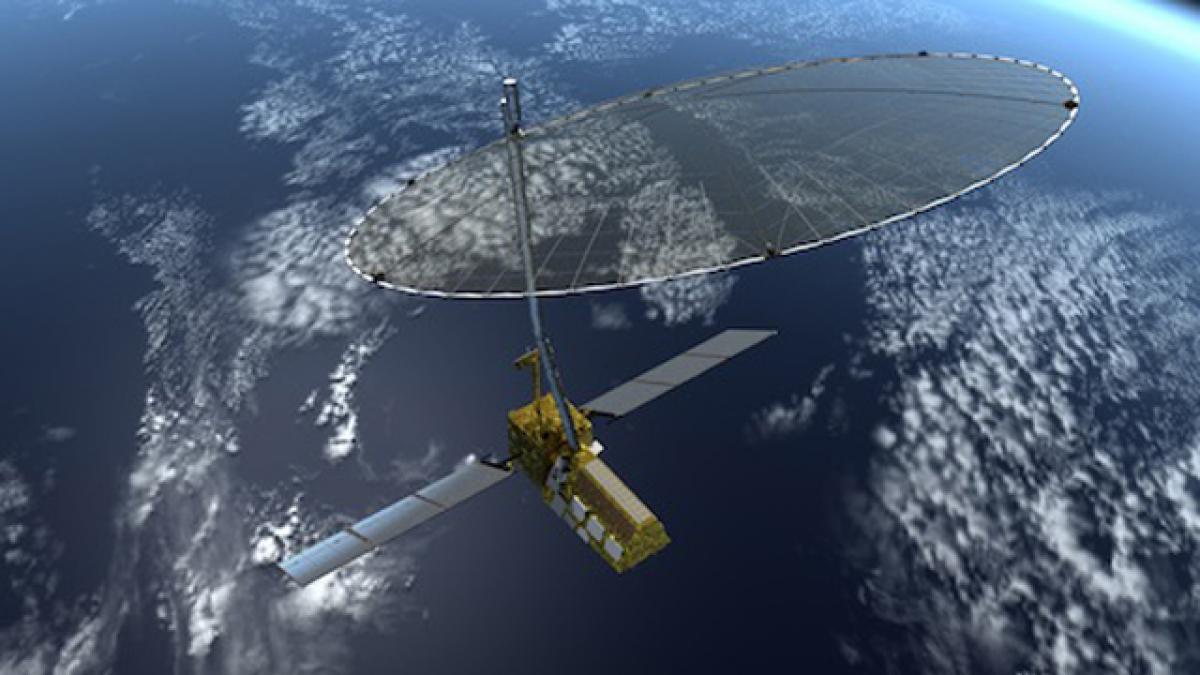
NISAR satellite


NISAR satellite. India and US have decided to put their collaborative earth observation satellite NISAR into orbit by 2021, according to ISRO chairman AS Kiran Kumar. Indian Space Research Organisation is collaborating National Aeronautics and Space Administration (NASA) of the US for the project.
India and US have decided to put their collaborative earth observation satellite NISAR into orbit by 2021, according to ISRO chairman AS Kiran Kumar. Indian Space Research Organisation is collaborating National Aeronautics and Space Administration (NASA) of the US for the project.
NISAR (NASA-ISRO Synthetic Aperture Radar) will be a dedicated mission to optimally measure intrinsic changes of the Earth’s surface associated with motions of the crust and ice surfaces.
NASA has been studying concepts for a Synthetic Aperture Radar (SAR) mission to determine Earth change in three disciplines — ecosystems, solid earth and cryospheric sciences. In the course of these studies, a partnership with Isro developed that led to a joint mission.
ISRO has identified a range of applications of particular relevance to India that the mission will address, including monitoring of agricultural biomass over India, snow and glacier studies in the Himalayas, Indian coastal and near-shore ocean studies, and disaster monitoring and assessment.
Using advanced radar imaging that will provide an unprecedented, detailed view of Earth, the NISAR satellite is designed to observe and take measurements of some of the planet's most complex processes, including ecosystem disturbances, ice-sheet collapse, and natural hazards such as earthquakes, tsunamis, volcanoes and landslides.
Scientific Instruments aboard the satellite will be: L-band (24-centimeter wavelength) Polarimetric Synthetic Aperture Radar; and - S-band (12-centimeter wavelength) Polarimetric Synthetic Aperture Radar. Its advanced radar imaging will observe and take measurements of some of the planet's most complex processes, including ecosystem disturbances, ice-sheet collapse, and natural hazards such as earthquakes, tsunamis, volcanoes and landslides.
Under the terms of the agreement, NASA will provide the mission's L-band synthetic aperture radar (SAR), a high-rate communication subsystem for science data, GPS receivers, a solid state recorder, and a payload data subsystem. ISRO will provide the satellite bus, an S band synthetic aperture radar SAR, the launch vehicle and associated launch services.
The satellite is likely to be launched from India aboard an Indian launch vehicle. The satellite will be 3-axis stabilised and is planned to be launched into a Sun-synchronous dawn to dusk orbit with a mission life of 3 years. The project has passed the first stage of the design validation phase and has been reviewed and approved by NASA.


