Live
- Congress targeting nationalists to divide country: Dr Laxman
- BJP ‘charge sheet’ accuses BJD govt of rampant corruption
- Delhi court reserves orders on bail petition of Kavitha for May 6
- Konda Vishweshwar Reddy holds rally in Tandur
- Revanth fielding dummy candidates to benefit BJP: KTR
- KTR takes part in road show to boost cadre morale
- YS Jagan Credits YSR for Development in Pulivendula, rubbishes political allegations
- Empowering Patient Education: A Conversation with Naresh Ahuja, CEO of SMS Scientific Products Pvt Ltd
- One dead after car hits lorry at Muthangi Outer Ring Road in Sangareddy
- WhatsApp Update: WhatsApp Introduces Passkeys for iOS, Secure Logins Without Passwords
Just In

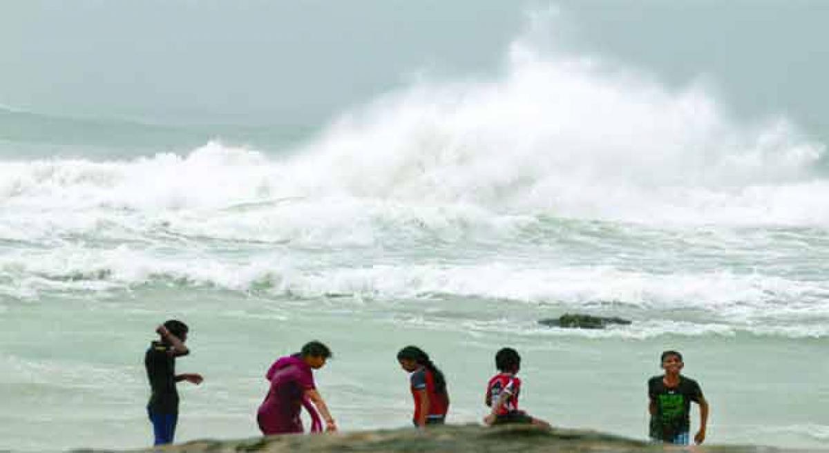
Heavy rainfall coupled with gusty surface wind is likely to pound North and South coastal areas of Andhra Pradesh and some parts of Odisha as the deep depression over west-central Bay of Bengal intensified into a cyclonic storm \'Roanu\' on Thursday.
Hyderabad: Heavy rainfall coupled with gusty surface wind is likely to pound North and South coastal areas of Andhra Pradesh and some parts of Odisha as the deep depression over west-central Bay of Bengal intensified into a cyclonic storm 'Roanu' on Thursday.
The deep depression over west-central and adjoining southwest Bay of Bengal moved nearly north-northeastwards before intensifying into the cyclonic storm and lay centered about 80 km from Machilipatnam and about 590 km southeast of Gopalpur in Odisha, the Meteorological Centre here said.
The IMD said winds at a speed of about 100 kmph could blow causing extensive damage to thatched huts, power and communication lines and roads over coastal Andhra Pradesh and Odisha during next 48 hours from Thursday night.
Fishermen have been advised not to venture into sea along and off Andhra Pradesh coast next 48 hours. District collectors in Andhra Pradesh have been asked to see that people staying in low-lying areas are shifted to safer places.
NDRF teams have been kept in readiness and essential items like medicines, drinking water and other material has been kept ready to meet any eventuality.
Heavy to extremely heavy rain and thundershowers along with squally winds over several parts of Andhra Pradesh such as Nellore and Vijayawada were witnessed on Thursday.
According to Skymet Weather, Roanu is likely to move in northeast direction and make landfall over Bangladesh coast by night of May 21 or early morning of May 22. However at the time of landfall, the system may weaken slightly and strike as a cyclonic storm only.
Coastal Andhra has been experiencing heavy rainfall since Thursday morning. Due to heavy gales followed by moderate rain, normal life was disrupted in Narsapuram and Eluru divisions since morning.
In Eluru, Nasapuram, Palacole, Bhimavaram areas the normal life has come to a standstill. In the upland area of the district, tree branches have fallen on the Power lines in various places .
The power went off in various villages since last evening. Palacole, Yalamanchili mandals power went off due to heavy gales and heavy rain since last night. In Achanta mandal, 11 villages are under darkness due to the power disruption.
About 18 fishermen who had ventured into the sea on country boats for fishing were reported missing in Nizampatnam mandal of Guntur district. The marine police officials succeeded in tracing one boat with six fishermen, Search is on for the remaining two boats.
They have informed the matter to the Coast Guard in Vizag and Navy officials to take further steps to establish contacts with them.
Kakinada in East Godavari district has already witnessed a record rainfall of 17.4 cm in the last 24 hours, which is said to be the highest in the last 10 years. This is followed by Bapatla in Guntur district which recorded 13.4 cm rainfall.
Heavy to very heavy rainfall is likely to occur at many places along coastal Odisha during the next 24 hours. According to IMD, heavy to very heavy rain at a few places with isolated extremely heavy rain is very likely to occur in Srikakulam, Vizianagaram, Visakhapatnam, East and West Godavari, Krishna, Guntur, Prakasam and Nellore till Friday.
Heavy to very heavy rain is likely at isolated places in Chittoor, Kadapa, Anantapur and Kurnool districts of Rayalaseema.
About 12 districts in Odisha are likely to be affected by the cyclone. The wind speed in Odisha coast is likely to remain within 100 kmph and 10 teams of Odisha Disaster Rapid Action Force (ODRAF) and fire service personnel have been asked to be ready for operation.

© 2024 Hyderabad Media House Limited/The Hans India. All rights reserved. Powered by hocalwire.com


