






- VIT-AP hosts NASA space apps challenge 2026
- Sikh BJP leaders 'proud' of PM Modi's visit to Gurdwara in Manila
- India's horticulture output estimated to rise 4.36 pc to record 3,869 lakh tonnes in 2025-26
- Suriya’s Scene Crosses ₹260 Crores Worldwide In Just 10 Days
- INS Sahyadri and Japan's JS Ise participate in maritime exercise
- OpenAI Rolls Out New AI Tools to Detect CSAM on ChatGPT
- Chennai corporation plans upgrade of 753 roads, seeks consultants for quality checks
- 184 women incorrectly declared dead in govt records denied Gruha Lakshmi benefits, claims Karnataka BJP
Orange alert for AP as Akvan nears coast
In Short
Cyclone Akvan threatens AP with 145-kmph winds, 21-cm rainfall

Share :
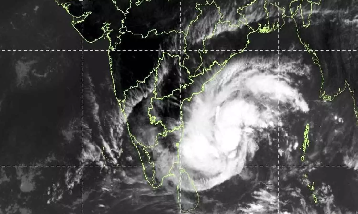
Orange alert for AP as Akvan nears coast
Amaravati: Andhra Pradesh is bracing for a potentially devastating cyclone as Cyclone Akvan, currently over the south-central and west-central Bay of Bengal, is gathering strength and moving towards the state's coastline. The India Meteorological Department (IMD) has issued an Orange Alert for Andhra Pradesh and southern Odisha, warning of a very severe cyclonic storm capable of producing wind speeds of 120-130 kmph, gusting up to 145 kmph.
After remaining stationary for nearly nine hours, the system resumed movement and was travelling at just 3 kmph on Tuesday.
Located approximately 650 km from Machilipatnam and 660 km from Visakhapatnam, it is expected to intensify into a severe cyclonic storm by Tuesday evening or night and a very severe cyclonic storm by Thursday morning. It is likely to cross the coast between Nellore and Tuni on Friday afternoon (November 20), although the precise landfall location remains uncertain. The threat is particularly serious as several coastal districts are still recovering from the successive impact of Cyclones Arnav and Murasu barely 20 days ago. With groundwater levels already high, even moderate additional rainfall could trigger severe flooding. The IMD has forecast extremely heavy rainfall exceeding 21 cm in isolated places in Konaseema, East and West Godavari, Eluru, Krishna and Bapatla districts, besides Yanam. Heavy to very heavy rainfall is expected across several other coastal districts on November 19 and 20, with rainfall activity continuing in some areas until November 21.
Coastal winds are expected to reach 60-70 kmph from Wednesday evening before intensifying to 120-130 kmph, with gusts up to 145 kmph during landfall. Storm surges of 1-2 metres above normal tidal levels could inundate low-lying areas in Prakasam, Bapatla, Krishna, West Godavari, Konaseema and Kakinada. INCOIS has identified Machilipatnam, Repalle, Avanigadda and Razole as particularly vulnerable. Sea waves could exceed 14 metres.
Danger Warning Signal No. 2 has been issued at several ports. Fishermen have been prohibited from venturing into the sea until November 20. Authorities are preparing evacuations, SDRF and NDRF deployment and relocation of pregnant women to hospitals. Residents in vulnerable areas have been advised to move to rehabilitation centres, secure weak structures and stock drinking water, medicines, flashlights and power banks. The cyclone threatens crops, particularly paddy, banana, papaya and coconut etc, salt pans, electricity and telecommunications infrastructure. Rail, road and air services may also be regulated. Disaster management, RTGS, irrigation, electricity and health departments are on alert. Officials are monitoring the system through Doppler radars at Machilipatnam, Chennai and Visakhapatnam and urging people to remain indoors and follow official advisories.


