




UNGA backs cartographic move to accurately reflect Global South
In Short
The UN General Assembly has backed the Equal Earth Projection map, aiming to provide a more accurate representation of continents and countries while addressing longstanding size distortions in traditional Mercator maps.

Share :
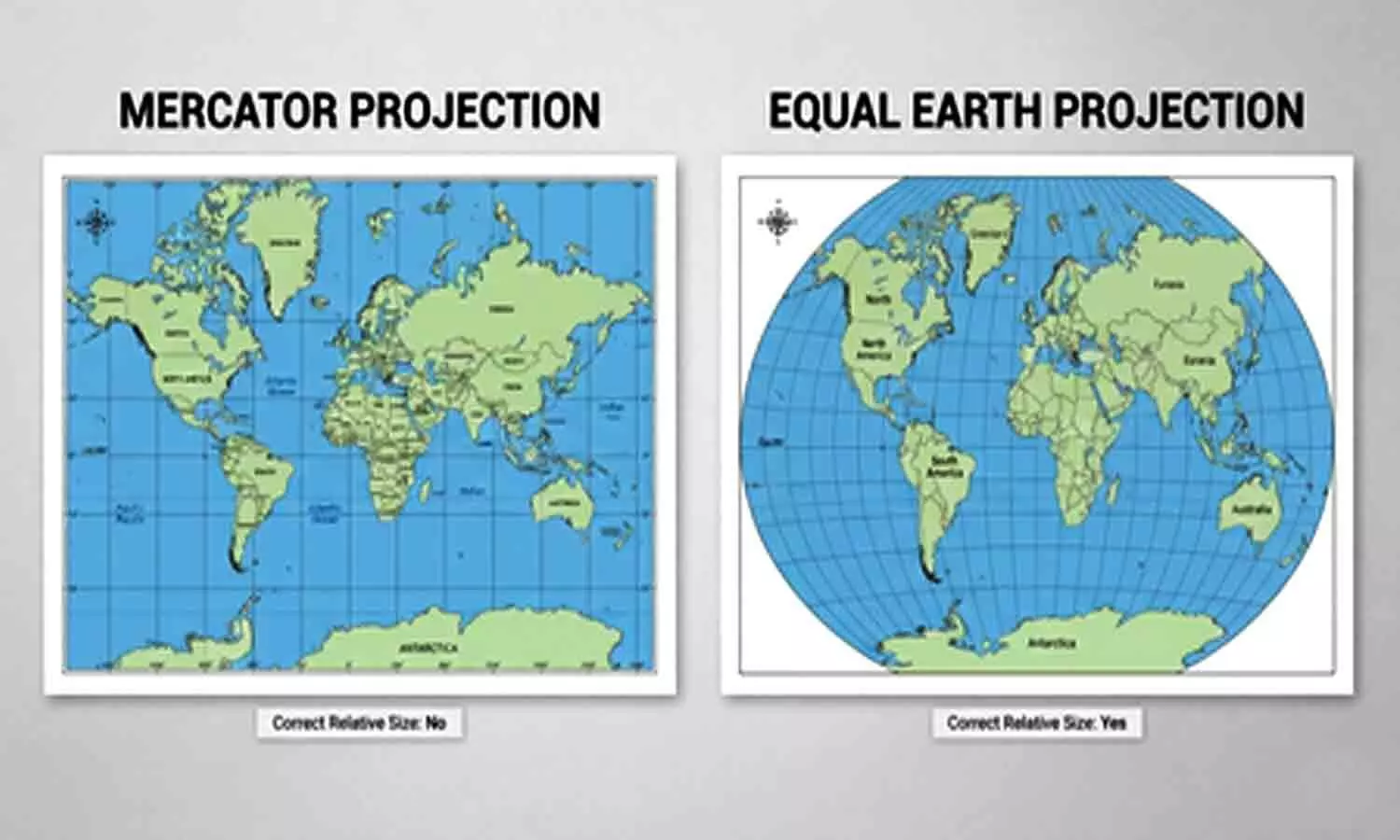
UNGA backs cartographic move to accurately reflect Global South
United Nations: In a cartographic push to reflect the Global South more accurately, the General Assembly has backed a world map that shows the true size of continents and nations.
In a resolution adopted with India's backing, the Assembly called on Friday for the adoption of the Equal Earth Projection map in place of popular maps like those using the Mercator Projection, which exaggerate the size of countries in the north.
The US was the sole objector to the resolution that was carried with 164 votes, with six abstentions.
The Mercator Projection, named for the 16th century Flemish mapmaker Gerardus Mercator, is still the most common basis for maps used around the world.
Mercator created the map for marine navigation as Europeans began their colonial conquests and it reflected the skewed worldview of that era in literal terms.
Togo's Foreign Minister Robert Dussey, whose country led the campaign for the change, said, “Correcting the map means recognising that every region of the world deserves to be represented accurately and with dignity".
The representation of India in the Equal Earth Projection does not change much.
The only discernable difference is that the peninsular part of India is slightly less angular than in the Mercator Projections, widening out a tiny bit in the Equal Earth Projection.
However, the US shown smaller in the Equal Earth map, truly reflecting its physical area relative to other countries.
The visual shrinkage on maps hit a nerve for the US under President Donald Trump, who seeks to enlarge its physical territory by threatening to capture Canada and Greenland.
Yaryna Ferencevych, a deputy US representative, denounced the Assembly resolution as part of "the much larger and more radical ideological project".
She said the UN was losing its credibility because of efforts like this.
Dussey said, “Our approach is not directed against any nation, any civilisation or any cartographic tradition".
"A fair map does not change the geography of the world; it changes how we see the world", he added. “And when our perspective becomes more just, it paves the way for greater understanding, respect and peace among nations".
Russia that looms large on Mercator maps is considerably reduced, but it supported the resolution describing it as anti-colonial.
The Assembly resolution is only advisory and does not require any nation or institution to ditch the Mercator-type maps for the Equal Earth maps.
The European Union, which supported the resolution, emphasised that it "is strictly limited to cartographic representation for educational, awareness-raising and geographical literacy purposes".
Earlier on Friday, the French Foreign Minister said his country was ditching the Mercator maps.
He said at Sorbonne University in Paris his ministry "will abandon the Mercator projection in favour of map representations tailored to specific uses, more faithful to actual surface areas".
The distortions in the Mercator maps are seen starkly in the depictions of Greenland, which is shown as having the same area as Africa, which has 14 times more physical area, and in Europe, which is shown as larger than South America, which is about 75 per cent bigger by area.


