






- HMWSSB MD calls for wider use of recycled wastewater
- BRS blames Congress for looming drinking water crisis
- Hyderabad: Park visitors cry foul over proposed fee hike
- Sonia Gandhi recalls fear of Indira, urges more youth to join politics
- Indian envoy meets Jakarta Governor, discusses sister city cooperation and Little India redevelopment
- FM Sitharaman chairs 2nd pre-Budget consultation with leading agriculture, rural development experts (Lead)
- Amit Shah unveils bust of Ajit Pawar in Pune; reveals the 'secret' behind his entry into Mahayuti
- Anbumani Ramadoss seeks urgent recruitment as TN govt colleges face faculty shortage
Cyclone Akvan poses fresh threat to Andhra Pradesh
In Short
- Landfall likely near Machilipatnam on Nov 19
- Wind speed at landfall may be 120–130 kmph

Share :
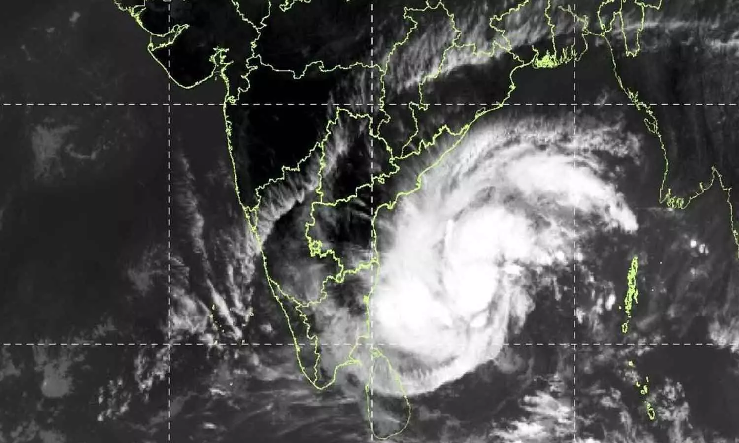
Cyclone Akvan poses fresh threat to Andhra Pradesh
Amaravati: Andhra Pradesh is bracing for another cyclone threat as a developing weather system over the Bay of Bengal is expected to intensify into a cyclone, raising concerns over heavy rainfall, destructive winds and possible storm surge along the state's coastline.
According to the weather update on Monday, the system, currently classified as a deep depression, is likely to strengthen into a cyclonic storm. It is forecast to intensify further over the next 48 hours, potentially developing into a very severe cyclonic storm. The system is likely to cross the Andhra Pradesh coast near Machilipatnam on November 19.
Coastal districts are expected to face strong winds, with wind speeds potentially reaching 145 kmph along the coast.
Heavy to extremely heavy rainfall and rough sea conditions are among the major threats associated with the approaching cyclone. The possibility of a storm surge could further increase the risk to low-lying coastal areas.
The India Meteorological Department (IMD) has indicated that the system will intensify into a cyclonic storm by Monday evening and a severe cyclonic storm by Tuesday evening. It is subsequently expected to strengthen into a very severe cyclonic storm and cross the Andhra Pradesh and Yanam coast between Nellore and Tuni around noon on November 20. The forecast wind speed at the time of landfall is 120–130 kmph, with gusts reaching 145 kmph.
Meanwhile, the Visakhapatnam Cyclone Warning Centre has undertaken additional atmospheric observations to closely monitor the developing system. A pilot balloon has been released to study upper-air conditions, including wind direction, wind speed and cloud movement and height. Such observations help meteorologists assess the cyclone's movement and changing atmospheric conditions and improve forecasting.
The approaching weather system has already begun influencing atmospheric conditions over Andhra Pradesh, with cirrus clouds appearing across parts of the state. These high-altitude clouds are among the visible changes being observed as the weather system develops over the Bay of Bengal.
The next 48 to 72 hours will be crucial, as the system is forecast to intensify and approach the coast. Coastal Andhra Pradesh is likely to experience heavy to extremely heavy rainfall, strong gale-force winds and rough sea conditions. The possibility of storm surges also poses a threat to low-lying coastal areas.
The IMD has advised coastal authorities and disaster management agencies to closely monitor the system and remain prepared to respond to any eventuality.
Cyclone Akvan poses fresh threat to Andhra Pradesh
Telangana on rain alert as cyclone threat looms
Charminar MLP project remains a non-starter
India-Egypt startup ecosystems can be a ‘force multiplier’: Piyush Goyal
‘Yogi Ki Pati’ completes 50 weeks; exhibition brings UP’s development story closer to youth
'Give me justice before it is too late': Imran Khan urges top Pakistani judges


