




- Digital resurvey to put an end to boundary disputes
- Congress will win 100 seats, Revanth to return as CM: TPCC chief
- Residents voice civic grievances to newly-elected 25th division corporator
- Global green warriors to take part in Climate Conclave on Dec 7: Uttam
- GHMC steps up sanitation drive after Deepavali
- Grand welcome to Satya Gaura Chandra Swami on initiation into sannyasa order
- HMWSSB boss’ fiat to officials : Complete Godavari water pipeline works by Nov 15
- Five fertility centre mgmts appear before Women’s Commission
Digital resurvey to put an end to boundary disputes
In Short
Telangana to complete resurvey in 18 months

Share :
Digital resurvey to put an end to boundary disputes
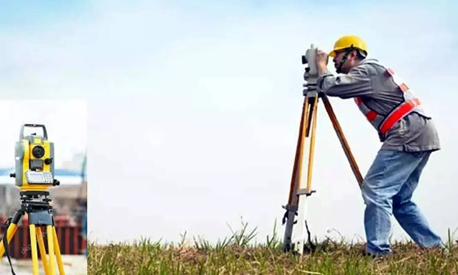
Hyderabad: Farmers may no longer need physical survey and boundary stones to identify the limits of their agricultural lands once the ongoing resurvey across Telangana is completed. The State Government is undertaking the exercise using advanced surveying technology, and the process is expected to be completed within the next one-and-a-half years.
Over the decades, many survey and boundary stones marking agricultural landholdings have been deliberately removed. In several instances, disputes have arisen after some landowners allegedly removed boundary stones to encroach upon neighbouring farmers' lands. Although a few stones remain intact, a large number have gone missing across the state, complicating the identification of land boundaries.
While speaking to The Hans India, Chief Commissioner of Land Administration (CCLA) and Revenue Department Secretary DS Lokesh Kumar said the ongoing resurvey is being conducted using advanced technology, including survey-grade GPS receivers and rovers. Survey teams are using pole-mounted GPS equipment connected to tablets to capture highly accurate geographical coordinates, including latitude, longitude and elevation with centimetre-level precision.
Lokesh Kumar said there would be no need to install physical survey or boundary stones after completion of the resurvey. Farmers would be able to identify and verify the boundaries of their agricultural lands through their mobile phones whenever doubts arise, he said.
Historically, systematic agricultural land surveys and the installation of boundary stones in the Telangana region date back to the Nizam era. The Marathwada Survey System was introduced during the 1920s and 1930s, with significant land records and village maps prepared during that period. The Survey and Boundaries Act, 1923, provided the legal framework for the establishment, maintenance and renewal of survey and boundary 'stones'.
Over the subsequent decades, these surveys were updated through various exercises, including those undertaken during the 1960s and 1970s. The latest resurvey marks a major shift towards technology-based land records management, with the government seeking to improve boundary accuracy, reduce land disputes and make land-related information easily accessible to farmers.
A farmer from Suryapet district, Ram Reddy, said land disputes had increased due to the alleged activities of unscrupulous farmers and the negligence of revenue officials. He alleged that some farmers repeatedly removed boundary stones to encroach upon neighbouring lands, while revenue officials failed to take action against such activities, particularly after the formation of Telangana state. He further alleged that some political, revenue and police officials were encouraging such practices for monetary gains. Despite submitting several applications seeking an 'enjoyment survey' to safeguard his land from encroachment by neighbouring farmers, he received no response from the revenue authorities or survey officials, he said.
Expressing confidence in the Congress government's ongoing resurvey initiative, Ram Reddy hoped that the exercise would protect the land rights of innocent farmers like him across the state and help prevent boundary disputes.
Congress tsunami will sweep away Modi, KCR: Revanth Reddy
AP eyes global investments at Partnership Summit
Addressing pensioners’ dilemma…AP extends OPS option to pre-2004 notified CPS staff
AP ranks 2nd in Access Equality Index
CM: Local poll outcome has endorsed NDA’s governance
Trump blames Iran war for Republican losses in midterm polls


