City's first-ever walkthrough map of major roads

City’s first-ever walkthrough map of major roads
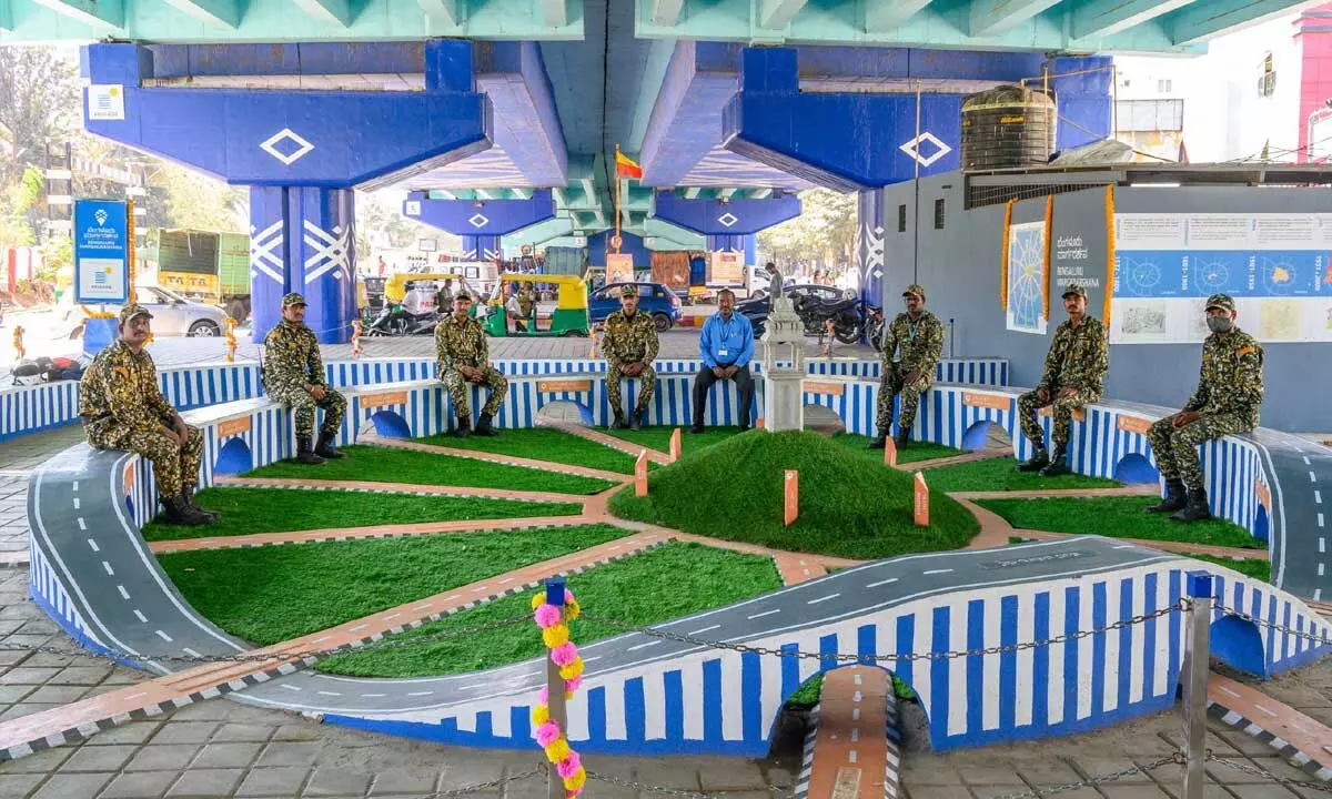
Bengaluru argadarshana, a first ever walk-through map of major roads and junctions that depicts how several major roads seamlessly connect to the central business district of the city was inaugurated by Pavitra Shankar, Managing Director, Brigade Enterprises Limited, on Friday.
Bengaluru: Bengaluru argadarshana, a first ever walk-through map of major roads and junctions that depicts how several major roads seamlessly connect to the central business district of the city was inaugurated by Pavitra Shankar, Managing Director, Brigade Enterprises Limited, on Friday.
Located under the flyover crossover after Hebbal junction near Nagashettihalli, Bengaluru Margadarshana, which is sponsored by Brigade Group in association with The Ugly Indian and BBMP also features brief narratives of five centuries of the expansion of Bengaluru since 1537 when the city was founded by Nadaprabhu Kempegowda. It is said that when Kempegowda built his new capital town, he called it Bengaluru as his mother and wife belonged to the hamlet of Hale Bengaluru (Old Bangalore).
Commenting on the initiative, Pavitra Shankar said, "The area is an important crossover point between Nagashettihalli, Kodigehalli and planned layouts like Devinagar and RMV extension. It is also adjacent to a railway crossing which makes it a crossover point for multi-nodal transport. We noticed that the large unused space at the crossover under the flyover was unkempt and doubled up as a garbage dump; and leveraged our association with The Ugly Indian and BBMP to beautify the area. The Ugly Indian team took it one step ahead by creating a one of its kind walk-through roadmap of Bengaluru. An added incentive for us to develop this crossing point was its proximity to Brigade Senate."
According to a co-ordinator from The Ugly Indian, "It's wonderful to see a joint initiative from a concerned corporate, local volunteers, traffic police and BBMP to improve the usability and aesthetics of an important junction - by creating a unique themed under-flyover space that is safe, clean, educational and creates a sense of pride in the city. Such initiatives create a sense of positivity that change is possible and provide a good example of government-citizen partnership to improve public spaces."
The two central pillars of the crossover point adjacent to the model walkthrough road map are painted in Navy blue that stands out against a backdrop of greenish light-blue ceiling of the flyover. Bold white 'Crossover' motifs on the dark blue background act as reflectors with mounted flood lights on the sides, visually reducing the heaviness of the pillars. There is also visual representation of how the city has grown over the last five centuries. The walk-through road map is a good learning experience for the public and for children as it highlights the history of the city.


