Hyderabad: Tree census, drive to save greenery in city
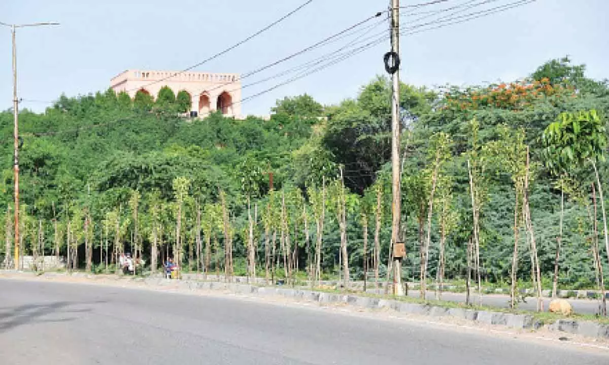
The surge in illegal tree chopping not only poses an immediate risk to the city's green cover but also raises apprehensions about the long-term impact on the local ecosystem
Hyderabad: To safeguard Hyderabad’s precious green cover, can there be a comprehensive tree census in the city? Recognising the vital role trees play in ecological balance and urban well-being, the census can meticulously identify and catalog every tree within the city limits.
The rampant and illicit felling of trees in recent times has set off alarm bells, sparking growing concerns over the imminent threat of environmental degradation. This surge in illegal tree chopping not only poses an immediate risk to the city's green cover but also raises broader apprehensions about the long-term impact on the local ecosystem.
Speaking to The Hans India, Uday Krishna, Vata Foundation, says, “Capitalising on the existing administrative division of the Greater Hyderabad Municipal Corporation (GHMC) into several zones, a pragmatic approach can be adopted to address the tree census challenge. Proposing a citizen-centric initiative, officials could leverage the community’s enthusiasm by inviting volunteers interested in participating in the tree count. By adopting a zone-wise strategy, the task becomes more manageable, and the involvement of local residents not only accelerates the process but also fosters a sense of community responsibility.
In this citizen-driven model, the emphasis shifts from significant financial expenditure to the mobilisation of manpower, making the tree census a collaborative effort between the administration and the residents.”
To streamline and expedite the tree census initiative, the administration can issue comprehensive guidelines outlining the methodology and protocols for the enumeration process. Capitalising on the existing workforce, the administration can efficiently pool in the expertise of the current staff, ensuring a coordinated and well-executed census. A matter of growing concern has surfaced as translocated trees, once relocated for preservation, are reportedly not receiving the requisite care and attention post-transplantation.
Disturbingly, it appears that governmental oversight diminishes after the initial relocation process.
Seeking anonymity, an official from the National Remote Sensing Centre (NRSC), says, “Undoubtedly, undertaking a comprehensive tree census is a time-consuming endeavour, yet the GHMC can overcome these challenges with a determined approach. The complexity of the task necessitates meticulous identification of tree types, assessment of their age, and consideration of their proximity to infrastructure such as roads and electric poles.
Despite the intricacies involved, this ambitious exercise is entirely feasible with careful planning and execution. By categorising and prioritising areas based on factors like tree species, age, and proximity to critical structures, the GHMC can efficiently navigate through the intricacies of the census. While the task is undoubtedly substantial, the potential benefits in terms of informed environmental conservation and sustainable urban planning make it a worthwhile and essential undertaking for the welfare of Hyderabad's green ecosystem.”
Farida Tampal, World Wide Fund (WWF), one of the members of Tree Protection Committee says, “It is not possible to carry out a tree census as it requires greater man power, may be still if we want to go ahead it can be possible through spatial GIS platforms, or ground truthing, and most importantly lest not forget after the implementation of Haritha Haram programme, the tree cover has significantly gone up.- Undoubtedly, conducting a tree census poses substantial challenges, particularly in terms of manpower. However, there are innovative approaches that can be explored to make this ambitious task feasible. Leveraging spatial Geographic Information System (GIS) platforms can provide a technologically advanced solution, streamlining the data collection process and enhancing efficiency. Additionally, ground truthing, involving on-site verification, can complement GIS data to ensure accuracy.”


