Vastu key factor in capital plan

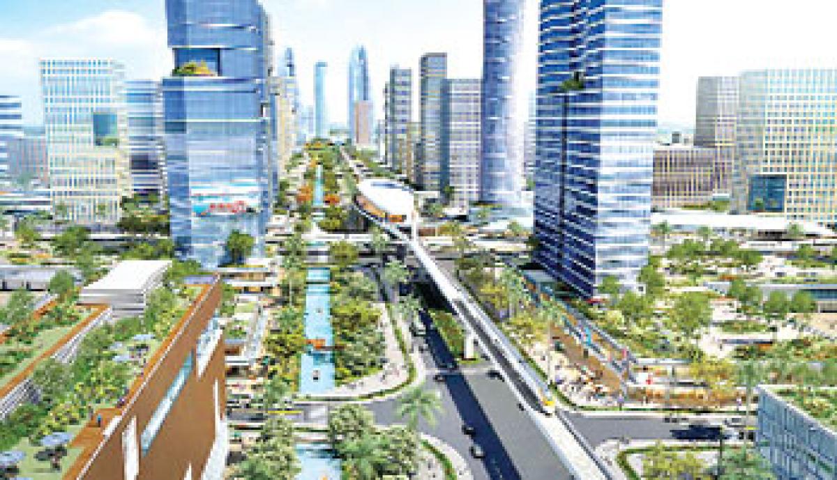
Vastu seems to be playing a key role in Amaravati capital draft master plan. The government has decided to construct government buildings, including Assembly and Secretariat at Rayapudi village of Guntur district with Krishna river flowing towards north-east.
 Vijayawada: Vastu seems to be playing a key role in Amaravati capital draft master plan. The government has decided to construct government buildings, including Assembly and Secretariat at Rayapudi village of Guntur district with Krishna river flowing towards north-east.
As Chief Minister N Chandrababu Naidu is keen on developing Amaravati as one of the best among international cities, the officials made changes to the master plan as per his directions.
It may be noted here that when Reliance Communications Chairman Anil Ambani met the Chief Minister in Vijayawada on Saturday, the latter said to have explained the former on capital development as the Reliance Group has expressed keen interest in connecting all villages with high-speed internet.
Sri Kanaka Durga temple chief priest Vishnubhotla Sivaprasad Sarma, who accompanied the Chief Minister to spray the holy water of all rivers in capital region, said that Amaravati would witness rapid growth as it matches perfectly with vastu and the Krishna river flowing towards east of the capital.
After making minor changes, the government released the draft master plan with Lingayapalem, Uddandarayapalem, Tallayapalem and Rayapudi as administrative zones with government offices, Anantavaram, Thullur, Dondapadu, Malkapuram, Krishnayapalem, Betapudi, Kuragallu and Penumaka as commercial zones, Nekkallu and Tallayapalem as business zones, Nulakapeta as logistics hub, Vaddamanu, Nidamarru, Nekkallu and Nulakapet as industrial zones, Yerrabalem as prohibited area, Nelapadu, Sakhamuru and Kishnayapalem as education zones.
The government issued notification on December 26 midnight under Section 39 of APCRDA Act 2014 for the draft master plan as the CRDA has to issue notification within two years after its formation which falls on December 30 as per the Act. The officials said that draft plan and reports are available on website (www.crda.ap.gov.in) and also at the offices of APCRDA, Vijayawada, Guntur, Tenali (Chenchupet) and Thullur for viewing on all working days.
When ‘The Hans India’ contacted majority of people in capital region, they said that they are not aware of the master plan and some of them said they are unable to download the master plan. As per the notification, the villagers can raise objections if any, on draft master plan within 30 days.
The 25 villages to come under capital region are Lingayapalem including hamlet village of Modugulankapalem, Uddandarayunipalem, Velagapudi, Nelapadu, Sakhamuru, Ainavolu, Malkapuram, Mandadam including hamlet village of Tallayapalem, Ananthavaram, Nekkallu, Thullur, Dondapadu, Abbarajupalem, Rayapudi, Borupalem, Kondamarajupalem (de-populated), Pichukalapalem of Thullur mandal, ,Undavalli, Penumaka-part of Tadepalli Municipality, Nulakapet, Dolas Nagar of Tadepalli mandal, Krishnayapalem, Nidamarru, Kuragallu including hamlet village of Neerukonda, Nowluru including hamlet villages of Yerrabalem and Bethapudi of Mangalagiri mandal.
As per the CRDA Act, perspective plan is prepared for an area of 8,603.32 sq km with 75 mts wide internal ring road, 150 mts wide outer ring road, dedicated freight corridor, high-speed rail, inland waterways-4 and suburban rail. Multi-model integrated transport hub is also proposed.
The entire area is divided into 8 planning zones which are centered around an existing town assigning specific economic activity for each zone. Ecologically-sensitive areas like water bodies, forests and heritage sites would be preserved. Development corridors on major roads are also proposed.
As per the master plan of capital city, the total area covers 217 sq km falling in 25 revenue villages. The capital city was divided into nine economic theme cities including Government, Finance, Tourism, Knowledge, Health, Electronics, Media, Justice and Sports.
Next Story


