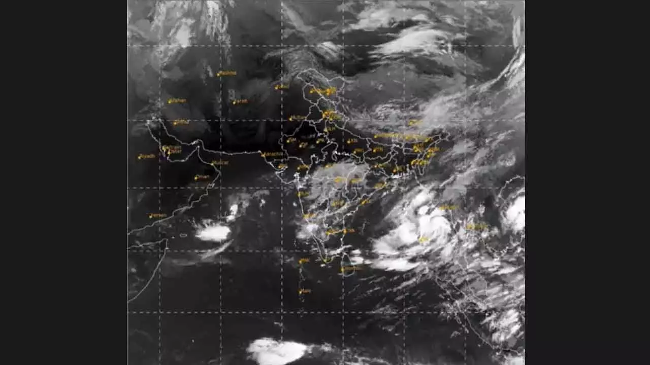
Cyclone brewing over Bay of Bengal

Bhubaneswar: A cyclonic storm is likely to form over the Bay of Bengal by October 23, affecting the coastal areas of Odisha and West Bengal, the IMD said on Sunday. An upper air cyclonic circulation over the Andaman Sea is likely to intensify into a low-pressure area over the Bay of Bengal during the next 24 hours, a special weather bulletin said.
The weather system is expected to move west-northwestwards direction, and intensify into a depression by October 22 morning and into a cyclonic storm by October 23 over east-central Bay of Bengal, it said.
“Thereafter, it is very likely to move northwestwards and reach the northwest Bay of Bengal off Odisha-West Bengal coasts by October 24 morning,” it added.Under its influence, the coastal region of Odisha and West Bengal is likely to receive heavy rainfall from October 23 to 25, the IMD said, advising fishermen to return to the shore by October 21.
The IMD Director-General, Mrutyunjay Mohapatra, said the system is likely to take the shape of a severe cyclonic storm.He said parts of Odisha are likely to experience heavy to very heavy rainfall from October 23 onwards.
“Some places in the coastal region may experience 20 cm rainfall on October 24-25. The intensity of the spell may also increase to 20 cm to 30 cm, and above 30 at some places,” he told a local TV channel.The IMD has not made any forecast on landfall location and intensity, he said. Light to moderate rainfall is also likely in West Bengal and Andhra Pradesh, the bulletin said.Squally wind with speed reaching 40-50 kmph gusting to 60 kmph is very likely to commence from October 23 evening on Odisha-West Bengal coasts. It would gradually increase to 100-110 kmph gusting to 120 kmph from October 24 night to October 25 morning.The IMD said during that period, the sea conditions are likely to be rough.
Meanwhile, State Revenue and Disaster Management Minister Suresh Pujari said the government is fully prepared to deal with the situation and all necessary steps have been taken to ensure safety and security of the people. TheState government has started taking steps in advance to reduce the impact of the possible cyclone, he said. Detailed discussions have been held with the officials concerned and the administration in different districts have been asked to stay alert to deal with the situation, he added.
Pujari said Odisha Disaster Rapid Action Force (ODRF), National Disaster Response Force (NDRF) and Fire Service officials have been asked to remain alert. The district collectors have been asked to prepare cyclone shelters in their respective areas to accommodate people if it becomes necessary to evacuate villagers from vulnerable areas, the minister said.

