Land Utilisation Pattern in Bangaru Telangana

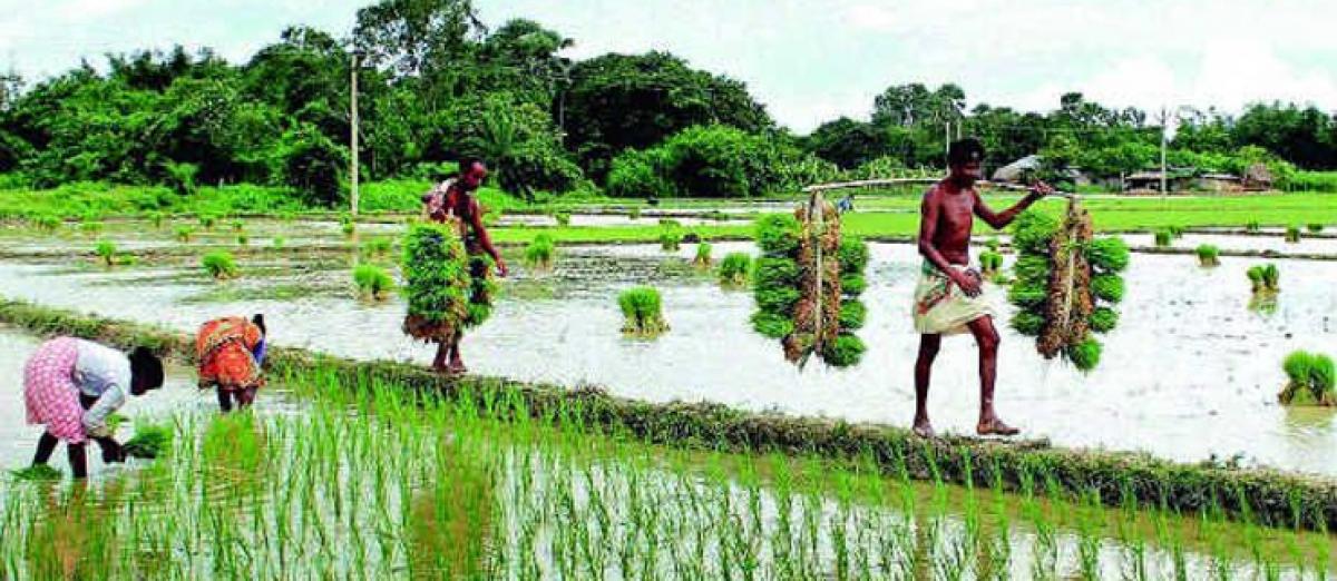
Telangana State is 12th largest State in India with the geographical area of over 112.08 lakh hectares. Of the total area about 39 percent is under agriculture and around 23 percent is under forest cover.
Land Utilisation Pattern
Telangana State is 12th largest State in India with the geographical area of over 112.08 lakh hectares. Of the total area about 39 percent is under agriculture and around 23 percent is under forest cover. Land put to non-agriculture uses is around 8 percent. Details of land utilisation pattern are given in Figure 3.3.
Agro Climatic Zones in Telangana:
Telangana State has been divided into four agro-climatic zones based on the geographical characteristics such as rainfall, nature of soils, climate etc.:
i) Northern Telangana Zone,
ii) Central Telangana Zone,
iii) Southern Telangana Zone and
iv)High Altitude and Tribal Zone.
1.Northern Telangana zone: This zone includes Adilabad, Karimnagar and Nizamabad Districts spreading over a geographical area of 35.5 sq. km. Annual rainfall ranges from 900 mm to 1150 mm, received mostly from the south west monsoon. Maximum and minimum temperatures during this season range between 210C - 250C and 320C -370C respectively. Red soils are predominant in this zone, which includes chalkas, red sands and deep red loams along with very deep black cotton soils. Rice, maize, soyabeen, cotton, red gram and turmeric are important crops grown in this zone etc.
2.Central Telangana zone: This zone includes Medak, Warangal and Khammam Districts and receives an annual rainfall of 800 mm-1150 mm. This zone spreads over a geographical area of 30.6 sq. km. Maximum and minimum temperatures during south-west monsoon ranges between 21°C - 250C and 220C - 370C respectively. Red soils are predominant which includes chalkas, red sands and deep red loams along with very deep black cotton soils. Important crops grown in this zone include cotton, rice, maize, green gram, mango, and chillies etc.
3.Southern Telangana zone: This zone comprises the districts of Rangareddy, Hyderabad, Mahabubnagar and Nalgonda, spreading over a geographical area of 39.3 sq. km. The annual rainfall is 600 mm -780 mm. Maximum and minimum temperatures during south-west monsoon ranges between 280C - 340C and 220C - 230C respectively. This zone is predominantly red soil track having red with loamy subsoil, i.e., chalkas. Important crops grown in the zone includes cotton, rice, red gram, maize, and green gram etc.
4.High Altitude and Tribal zone: This zone consists of the areas along Northern and Eastern borders of Adilabad and Khammam districts, spreading in about 4.66 sq. km and is mostly inhabited by Tribal population. The annual rainfall is around 1400mm.Important soils in this zone include red sandy loams, red loams with clay base along with very small patches of alluvial soils. The maximum and minimum temperatures during south-west monsoon ranges between 130C - 270C and 290C - 34°C respectively. Important crops grown in this zone include chillies, rice, cotton and horticultural crops etc.
Rainfall
Normal rainfall of Telangana State is about 905.3 mm as against India’s normal rainfall of 1083 mm. About 80 percent of the total rainfall in the State is being received during South-West monsoon (June to September). There has been an acute deficiency of rainfall in previous two years, i.e., 2014-15 and 2015-16. The actual rainfall received during South-West monsoon of 2014-15 was 494.7 mm as against the normal rainfall of 713.5 mm, recording a deficit of –31%. There was a deficit in rainfall in nine out of ten districts in the State (except in Mahabubnagar) during this period. Deficiency in rainfall in the current year 2015-16 continued to persist. The State received an average rainfall of 611.2 mm during the South West Monsoon (June - September), as against the normal rainfall of 713.6 mm resulting a deficiency of -14 percent.
Note: *Total rainfall related to 2015-16 is to end January 2016.
Table 3.2: District Wise Status of Rainfall from 01-06-2015 to 30-09-2015
| Sl.No | District | Total Number of Mandals | No. of Mandals | ||||
| No Rain -100% | Scanty | Deficient | Normal | Excess >19% | |||
| -99 to -60% | -59 to - 20% | -19 to 19% | |||||
| 1 | Adilabad | 52 | -- | -- | 21 | 31 | -- |
| 2 | Nizamabad | 36 | -- | 1 | 34 | 1 | -- |
| 3 | Karimnagar | 57 | -- | - | 27 | 27 | 3 |
| 4 | Medak | 46 | -- | 2 | 41 | 3 | - |
| 5 | Hyderabad | 16 | -- | -- | 7 | 6 | 3 |
| 6 | Ranga Reddy | 37 | -- | 2 | 23 | 10 | 2 |
| 7 | Mahabubnagar | 64 | -- | 4 | 36 | 23 | 1 |
| 8 | Nalgonda | 59 | -- | - | 15 | 32 | 12 |
| 9 | Warangal | 51 | -- | -- | 2 | 34 | 15 |
| 10 | Khammam | 41 | -- | -- | 3 | 27 | 11 |
| State Total | 459 | -- | 9 | 209 | 194 | 47 | |
Source: Directorate of Economics & Statistics, Government of Telangana
Deficiency in Rainfall:
Deficiency in rainfall during 2014-15 and 2015-16 aggravated the drought conditions in the state hindering State’s economy growth in general and agriculture in particular. Further analysis shows that 9 Mandals in the State experienced more than 60 percent deficiency and about 45 percent of Mandals in the State have more than 20 percent deficiency in rainfall during South-West monsoon. District-wise analysis shows that significant number of Mandals in the districts of Nizamabad and Medak received deficient rainfall.
G.Rajendera Kumar
Woman injured in stabbing attack in Tokyo, suspect at large
Bengal cop booked for murder over mysterious death of woman home guard, SIT to probe case
Staffer recalls horror of 7-kg gold robbery by armed gang in Karnataka’s Hunsur
25-Year-Old Airline Cabin Crew Member Dies At Gurugram Party; Police Begin Investigation


