NASA's OpenET System Revolutionizes Water Management with Satellite Data

In a significant development for sustainable water management, NASA's OpenET system has proven its effectiveness in tracking evapotranspiration (ET) over crops and natural landscapes.
In a significant development for sustainable water management, NASA's OpenET system has proven its effectiveness in tracking evapotranspiration (ET) over crops and natural landscapes. Leveraging data from NASA's Landsat program, OpenET utilizes an ensemble of six satellite-driven models to calculate the movement of water vapor from soil and plant leaves into the atmosphere. The system's success in a large-scale analysis was recently published in Nature Water.
OpenET, developed under the Technology Development Fund (TDF) scheme of NASA, employs publicly available data from Landsat to provide high-resolution calculations of ET on a field-level scale. This innovative approach significantly enhances the way farmers, ranchers, and water resource managers handle water resources.
The system's accuracy was put to the test through a comparison with ground-based measurements from 152 sites across the United States. In agricultural areas, OpenET demonstrated high accuracy in calculating ET, especially for annual crops such as wheat, corn, soy, and rice. The study's lead author, John Volk, expressed pleasant surprise at the results, highlighting the system's strength in western arid regions where water sustainability challenges are prevalent.
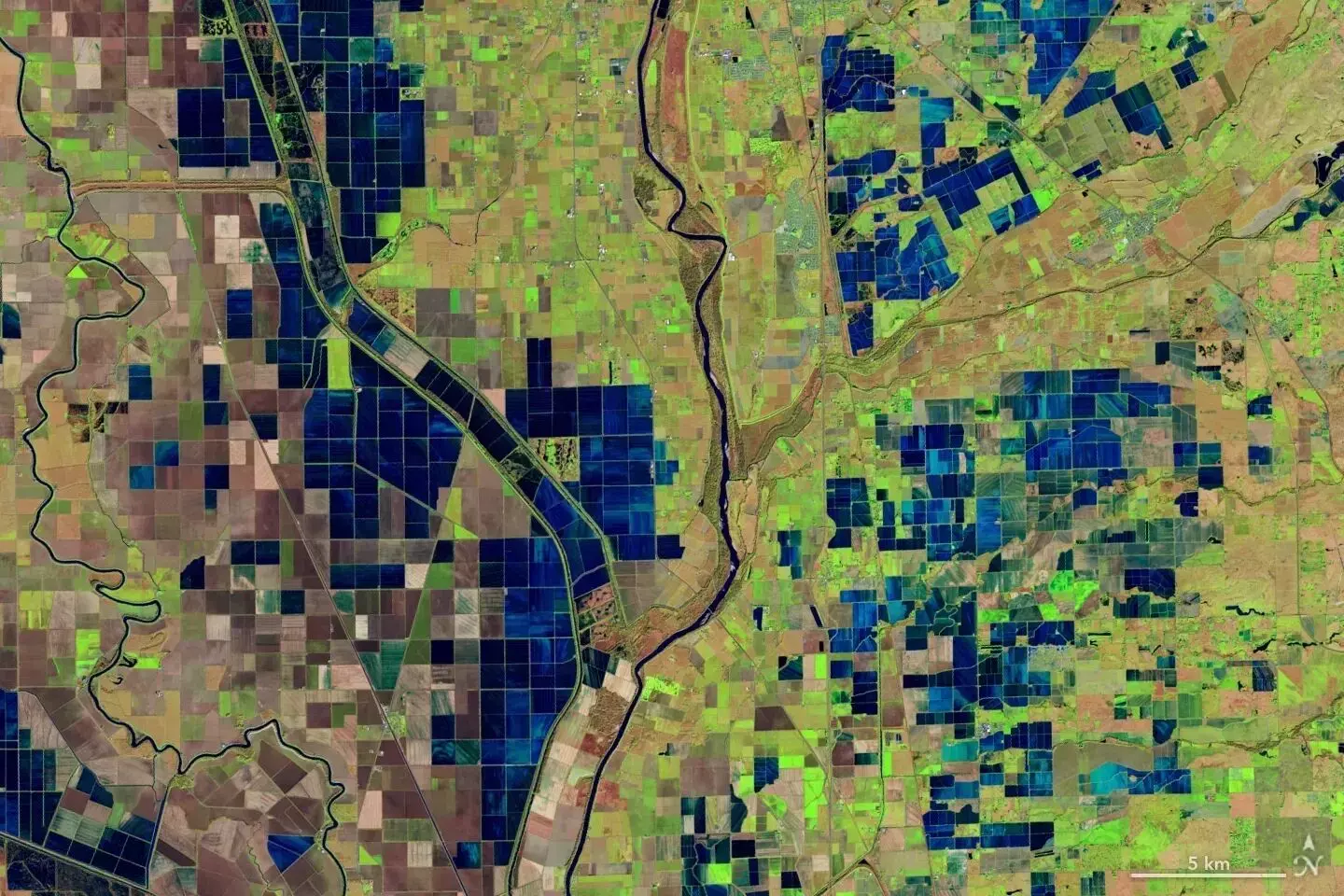
OpenET's impact is already evident in Northern California's Sacramento-San Joaquin Delta, where water resource managers are utilizing the system to assist farmers in complying with state regulations on reporting water use.
Evapotranspiration, the process of water moving to the atmosphere from the surface, is a crucial factor in estimating water availability for crops and plants. While challenging to calculate, OpenET makes this unseen process more accessible by utilizing satellite data for consistent monitoring. The system's primary observations come from the Landsat 8 and 9 satellites, providing high-resolution data on land surface temperatures and vegetation health.
The recent large-scale analysis demonstrated that OpenET data for agricultural lands had an average error rate of about 10-20% for monthly, growing season, and annual timescales. This success solidifies OpenET's position as a game-changer in water management, offering a cost-effective and efficient solution for tracking and managing water resources.
The OpenET consortium, consisting of NASA, the U.S. Geological Survey (USGS), the U.S. Department of Agriculture, Desert Research Institute, several universities, Environmental Defense Fund, and Google Earth Engine, continues to advance this transformative technology. As the world seeks sustainable solutions, OpenET's integration of satellite data marks a significant step forward in responsible water resource management.


