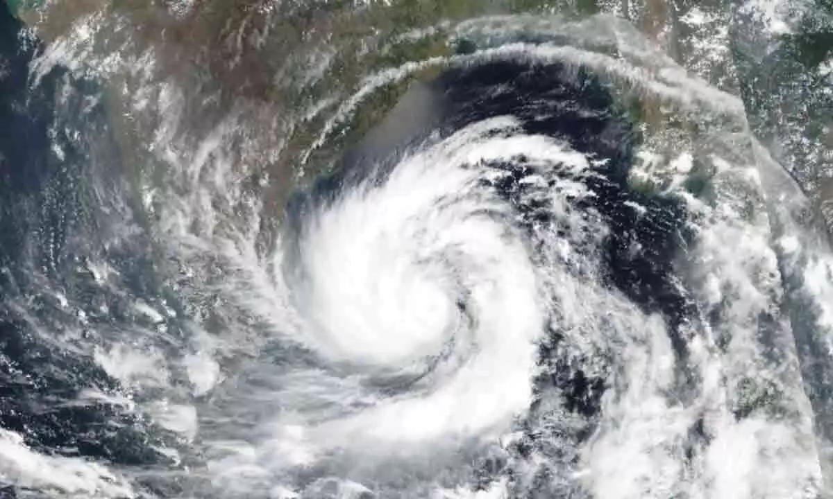
Cyclone 'Michaung' Alert: IMD Issues Warning As Coastal Regions Brace For Intensifying Storm

- 1. The India Meteorological Department (IMD) has issued a high alert as Cyclone 'Michaung' gains strength over the Bay of Bengal.
- 2. With forecasts predicting landfall between Nellore and Machilipatnam, coastal regions are on standby, with governments declaring holidays and response teams prepared.
The India Meteorological Department (IMD) is on high alert as Cyclone 'Michaung' gathers strength over the Bay of Bengal and the South Andaman Sea. Predicted to skip Chennai, the cyclone is expected to make landfall between Nellore and Machilipatnam on Tuesday morning, carrying winds reaching speeds of up to 100 kmph.
Forecasts indicate that the cyclone will intensify into a cyclonic storm over the Southwest Bay of Bengal within the next 24 hours, subsequently reaching the west-central Bay of Bengal off south Andhra Pradesh and adjoining north Tamil Nadu coasts by December 4. The impending threat has prompted the Puducherry government to declare a holiday for colleges in Puducherry, Karaikal, and Yanam regions, with other state governments putting their response teams on standby. The Southern Railway has preemptively cancelled 118 trains in Tamil Nadu, including intra-state long-distance trains, from December 3 to 6.
Sunanda, the Managing Director of the Visakhapatnam Cyclone Warning Centre, provided insight, stating that the deep depression over the Southwest Bay of Bengal has been moving west-northwestwards and is currently centered near Latitude 10.6°N and Longitude 83.6°E. It lies approximately 440 km east-southeast of Puducherry, 450 km east-southeast of Chennai, 580 km south-southeast of Nellore, 670 km south-southeast of Bapatla, and 670 km south-southeast of Machilipatnam.
Sunanda added that the depression is likely to intensify into a cyclonic storm over the Southwest Bay of Bengal in the next 24 hours, moving northwestwards to reach the west-central Bay of Bengal off south Andhra Pradesh and adjoining north Tamil Nadu coasts by the forenoon of December 4. The cyclone is projected to move nearly northwards, parallel to the south Andhra Pradesh coasts, and make landfall between Nellore and Machilipatnam on December 5, bringing sustained wind speeds of 80-90 kmph, gusting up to 100 kmph.
S Balachandran, Deputy-Director General of Meteorology, Chennai, emphasized the continuous northwestward movement of the depression over the South West Bay of Bengal, projecting its concentration into a cyclone within the next 24 hours. The system is expected to move northwestward and reach the west-central Bay of south Andhra and north Tamil Nadu coast on December 4, moving parallel to the coast in a northward direction thereafter.
The Meteorological Office forecasts heavy rainfall in north coastal Tamil Nadu and Puducherry on December 3 and 4, gradually decreasing thereafter. Coastal Andhra Pradesh is anticipated to experience heavy rains until December 6, and in Odisha, heavy rainfall is predicted until the same date.
In response to the impending cyclone, the Weather Office has issued warnings to fishermen, advising them to avoid the Southwest Bay of Bengal, North Tamil Nadu, and Puducherry coasts until December 4, the west-central Bay of Bengal and Andhra Pradesh coast until December 5, and the South Odisha coast until December 5. Fishermen currently at sea are urged to return to the coast within the next 12 hours to ensure their safety.


