Flood safety wall is still pending in Kurnool
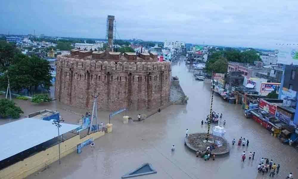 A file photo of Kurnool city submerged in floodwater in October 2009
The officials from Irrigation, Kurnool Municipal and Revenue departments have sent a proposal to the State government for the construction of flood protection wall to prevent the city from flooding.
Kurnool: The officials from Irrigation, Kurnool Municipal and Revenue departments have sent a proposal to the State government for the construction of flood protection wall to prevent the city from flooding. In 2009, water from Tungabhadra and Handri rivers had entered the Kurnool city.
Recalling the nightmarish experience ten years ago, residents of Kurnool had demanded that the government should construct a protection wall from floods to prevent submerging of the city. The then State government gave an assurance of constructing protection wall but it is still only on the paper.
The political involvement is said to be reason for keeping the project pending. On several occasions, the people of Kurnool city urged the government to give priority for the completion of flood wall construction and save them from the floods. If the wall is not constructed, then the safety of Kurnool city would be in jeopardy.
The three rivers, Krishna, Tungabhadra and Handri have received heavy inflows due to incessant rains in the catchment area that resulted flooding Kurnool city in October 2009. All these three rivers merge in and around Kurnool city.
Rivers Tungabhadra and Handri join together on the outskirts of the city and flows further downstream till it joins Krishna river. In 2009, the Srisailam Dam could not handle the heavy inflow from these three rivers as a result the backwater has submerged Kurnool in the same year October.
The Srisailam Dam has withheld the heaviest inflows it had experienced of about 2.5 million cusecs (cubic feet flow per second) since its construction in 1981. According to an official of the Kurnool Municipal Corporation (KMC), maximum flood level of 284 metre above sea level was reached on October 2, 2009.
The city's contour map identifies the banks of the Tungabhadra river at 271 metres. So, the area between 271 and 284 metres contour lines has been marked as the inundated area and is divided into three categories of submergence like high, moderate and low.
As per these calculations, the officials have prepared a detailed report for the construction of protection wall named as flood safety wall, with an estimated cost of Rs 244 crore in 2009, a source of Irrigation department has said.
B Rajendra Prasad, Executive Engineer of the Safety Protection Wall speaking to The Hans India has said that we are again preparing a fresh proposal for the construction of protection wall. Earlier, the government has sanctioned Rs 244 crore for its construction.
Construction of two bridges one at Anand theatre and the other at Joharapuram have been taken up. Some more works have been done under Neeru-Chettu programme, said the Executive Engineer.
He further said that they are receiving applications during Spandana programme demanding a wall. Based on the demand, we are again preparing a fresh proposal to send to the government for getting administrative sanctions. After we receive the sanctions the remaining works will take place, he added.


