Live
- Chandrababu Advocates Strict Measures for Social Welfare and Infrastructure Development in AP
- Show of brotherhood by Vijayan, Stalin at event to honour Dravidian icon
- District Collectors’ conference with CM begins
- Celebrations kick off in Saudi Arabia to welcome FIFA World Cup 2034
- Google Unveils Jules AI to Help Developers Fix Code Errors
- Bengaluru Techie’s Tragic Suicide Sparks Outrage Over Family Disputes and Legal Failures
- Crucial Union Cabinet meeting to discuss One Nation One Election
- Irrigation AE Nikhesh Kumar Arrested in Disproportionate Assets Case, Granted 4-Day Custody
- Your Daily Horoscope for December 12, 2024: Unlocking Mysteries of the Stars
- Hyderabad: 18-Month-Old Girl Dies After Being Hit by Car in Jawaharnagar
Just In

The common man in India has to wait for some more time to use the \"Indian GPS\' as the Indian navigation system has to be formally declared operational after checking and cross-checking, industry officials said.
The common man in India has to wait for some more time to use the "Indian GPS' as the Indian navigation system has to be formally declared operational after checking and cross-checking, industry officials said.
They also said government mandating the use of the Indian Regional Navigation Satellite System (IRNSS) will act as a booster for the domestic manufacturing of satellite signal receivers as a part of the Make in India initiative.
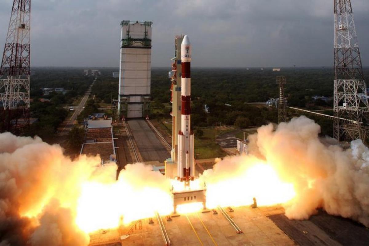
India on Thursday put into orbit its seventh navigation satellite -- IRNSS-1G -- and joined a select group of space-faring nations with their own satellite navigation system. Simply put, the IRNSS is similar to the global positioning system (GPS) of the US, Glonass of Russia, and Galileo of Europe as well as China's Beidou.
According to India Space Research Organisation (ISRO), the applications of IRNSS are: terrestrial, aerial and marine navigation, vehicle tracking and fleet management, terrestrial navigation for hikers and travellers, disaster management, integration with mobile phones, mapping and geodetic data capture and visual and voice navigation for drivers.
"The Indian system provides positional accuracy of 10 metres. For civilian usage to bloom and the cost to come down, more manufacturers have to start making the navigation signal receivers. That will happen once the IRNSS is formally declared operational," A.S. Ganeshan, retired programme director of ISRO's Satellite Navigation Progamme, told IANS.
He said the satellite navigation system comprises three segments -- space (satellites), ground (ground systems) and user (receivers).
The Indian space agency has to test all the three segments thoroughly before IRNSS could be declared an operational navigation system.
Ganeshan said once the IRNSS is ready, there will be greater development of application software that would be useful for different segments.
The IRNSS will provide two types of services - standard positioning service and restricted service. The former is provided to all users and the latter is an encrypted service for authorised users. Once the system is fully operational, India will not have to face of risk of the absence of satellite signals at critical times as the existing systems are owned by other countries.
While the defence forces would get the IRNSS signal receivers from the manufacturers, the challenge for deeper penetration of the Indian navigation system depends on the makers of signal receivers.
"The Indian government should mandate the use of indigenous satellite navigation systems by various government agencies and the emergency services like ambulance and others so that the signal receiver makers are enthused to get into accelerated production mode," Ganeshan added.
He said once the mandatory usage is there, more software applications could then be developed, thereby widening the usage.
Agreeing with him, S. Purushotham, director, Accord Software & Systems Pvt Ltd, told IANS: "If there is a mandate then it will give a big fillip for the receiver makers' Make in India efforts."
Nevertheless, Accord Software will get into making the IRNSS receivers as the company is confident that the Indian navigation system will soon be declared operational, Purushotham remarked.
The Bengaluru-based Accord Software clocked a turnover of around Rs.100 crore ($15 million) last year and has around 400 people on its rolls, Purushotham said.
"We are the only company to develop the receivers for IRNSS. We have delivered to ISRO and other agencies through ISRO for use in land and marine applications," he said.
Speaking about the the cost for the common man, Purushotham said it would depend on the volumes though the equipment will be priced competitively with that of GPS receivers.
According to Ganeshan, it will not be right to compare the seven-satellite IRNSS with that of the US GPS as the latter system consists of 24 satellites.
"The Indian system should be given some time before comparisons could be made," Ganeshan said.
"India will not be content with the constellation of seven navigation satellites and it will launch more such satellites," he added.

© 2024 Hyderabad Media House Limited/The Hans India. All rights reserved. Powered by hocalwire.com


