Water seeks its own level; let's understand it well
We grew up reading about the Sorrow of Bengal (Damodar River), Sorrow of China (Hwang Ho) and so on. These rivers cause devastating floods in their respective geographies.
We grew up reading about the Sorrow of Bengal (Damodar River), Sorrow of China (Hwang Ho) and so on. These rivers cause devastating floods in their respective geographies. Most of us tend to forget what we learn in our primary schools, environment and civic science or civics in particular. In my previous columns I discussed the pathetic state of urban planners who need to sensitise on environmental issues.
But today, I am happy to note that the Mamata Bannerjee government has decided to undertake a satellite imagery study of the flood pattern in the State. The State Irrigation & Waterways Department has roped in Noida based agri-tech company Leads Connect Services for assessment and demarcation of flood prone areas of the State. The project will be executed by using temporal satellite imageries to develop year wise flood inundation maps from historical available data and images.
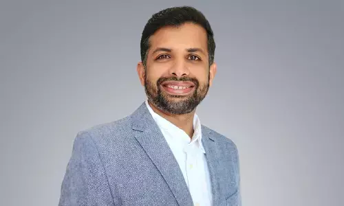
In addition, the objective of the project is also to determine district-wise flood prone area maps corresponding to different flood return periods. It will be conducted in the State's 23 districts for six months, starting from now. Navneet Ravikar, Chairman & Managing Director, Leads Connect Services said, West Bengal, being the lowermost riparian State of Ganga-Brahmaputra basins, has both inter-State catchment areas of 57,624 sq km and international catchment areas of 34,252 sq km., thus has no control over influx from the upper catchment areas.
The outfall tidal conditions often makes the situation worse and river bank erosion, coastal erosion, water logging, tidal inundation, cyclones/depressions are common phenomena of the State. As the monsoon rainfall normally starts from June and ends in October, the districts in the southern parts of the State experience heavy precipitation particularly in the months of September and October.
Consequently, upon development of low pressure/depressions in the Bay of Bengal during this period, major floods have been noticed to have occurred during this crucial period 1978, 1984, 1991, 2000 etc.
For starters, Leads Connect is an analytics company with core focus on agri-technology driven data analysis and modelling, risk management & financial services. And Ravikar says through this assessment project, the firm intends to make indicative flood prone area maps so that the situation in future doesn't get worse and proactive measures can be taken.
The comprehensive assessment of the earth system may be helpful in understanding the impact of one component on another. This understanding may help in developing sustainable frameworks for the future. Leads has the right credentials, having worked with nodal agencies such as Mahalanobis National Crop Forecast Centre (MNCFC), Agriculture Insurance Company (AIC), and NABARD Consultancy Services (NABCONS) for research-based project related to yield estimation, crop cutting experiments (CCE) and mapping agricultural infrastructures, respectively.
I discussed Leads in such detail here because what they are doing is the need of the hour. We do not have to wait for six months to see the results. All flood-prone States – including Rajasthan which has been having rains – can call Leads for presentation and check what they are doing. This will help us in many ways. First, we will know the flood pattern and how the water finds its own course. This will help us take precautions and instead of opting for flood relief camps, we may even look at permanent measures to save lives and livelihoods, apart from homes built with hard-earned money.
Second, this may help us plan water harvesting and build check dams effectively. There is no satellite science behind this. Often, flood-hit areas are the ones which reel under chronic water shortages as well. To give an example from my Karmabhoomi Mumbai, the island city is blessed with more than adequate rains with extended monsoons. Yet, the State is planning desalination plants to tide over water shortages while allowing all the rain water to flow into the sea. Yes, I will keep hammering this issue whenever I get an opportunity till the Maharashtra Government drops the desalination idea and starts conserving the God-given rain water.
We also need to take a fresh look at the river regulation zones, encroachments of banks and above all pollution by direct flow of sewer drains and industrial effluents into the rivers. I am not making any pre-election political statement. I am just stating the obvious as I am vexed with the Maharashtra Government's plans to have school buildings within the high flood line areas and even cut the flood line to facilitate constructions along the Ulhas River in Mumbai Metropolitan Region.
Waterman of India Dr Rajendra Singh pointed out to Maharashtra Environment Minister Aaditya Thackeray that the straight walls along the river banks is a bad idea. The walls, if a must, can be built in a Y shape, giving elbow room to rivers to flow. Dr Singh rightly questioned the urban or industrial development along the river banks instead of leaving river beds free of any encumberment. You don't need any satellite studies, Thackeray, to know that we should leave our rivers free to flow and not to have concrete jungles instead of strengthening the rain forests in catchment areas.
Prime Minister Narendra Modi recently gave, what his supporters would say, a clarion call to preserve 75 lakes in each district as a contribution for the 75th Anniversary of the Independence. The obsession with the figure 75 is fine but limiting the number of lakes to 75 per district is not a good idea because it is not good enough. ISRO's Space Application Centre has identified as many as 2,31,195 wetlands in the country in its National Wetland Atlas which has been uploaded on the Ministry of Environment, Forest and Climate Control. Considering that we have 765 districts, the average number of wetlands (above the size of 2.5 hectares each that are needed to be conserved as per the Supreme Court ruling) works out to over 300 each. The Prime Minister talks of 75 which is just one-fourth the actual numbers. Let the government divide all wetlands into parcels of 75 each, to retain the euphoria of Aazadi Ka Amrit Mahotsav, and task the officials to preserve and conserve them. This can be another Mann Ki Baat idea.
We have coined catchy slogans such as Jal Hi Kal Hai, Jal Nahin Kal Nahin, Jal Hi Jeevan and so on. These slogans are not to be left decorative paintings on walls for some Swachh Bharat or Environment Day campaigns. Environment or Nature are not abstract subjects about which we lecture at least half a dozen times a year and keep repeating every year.
Unfortunately, many of our Netas and bureaucrats have reduced these events to mere rituals, without either realising or deliberately ignoring the reality the environment concerns each one of us. Ignorance may be bliss but deliberately ignoring the importance of importance with a short-sighted approach is foolishness.
Jain monk Acharya Tulsi's Anuvrat movement talks of taking a small step at a time towards a big leap. Can we take this small step and say, 'I am the environment.' I am making a beginning. Let the caravan begin with us! 'I am Environment' has the potential of developing collectively into 'We are Environment.' Perhaps, we will then be able to connect with nature.


